HEAS Deputy Head Immo Trinks and HEAS Team Leader Wolfgang Neubauer Contribute to Paper on Durrington Walls Henge
More On Article
- It Takes Two to Tango: A Pluralist Account for Building Comprehensive Explanations in Human Evolution
- HEAS Member Has Article Recognized by Wiley as one of their Top 10% Viewed Articles of 2024
- Humans are not unique: difficult birth is common in placental mammals.
- Human childbirth is not uniquely difficult among mammals
- Osteoarchaeologist Ellen Green To Give A Talk At The ÖAI
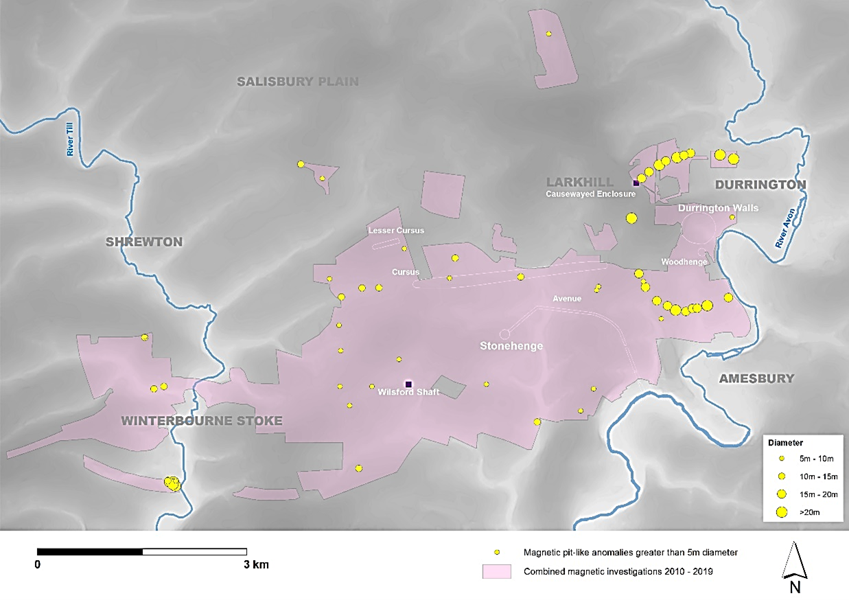
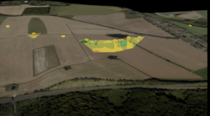
A new article has been published on the massive, neolithic pit structure recently discovered during geophysical survey around the Durrington Walls Henge, Wiltshire. Following their original discovery of what may be the largest Neolithic structure in Britain, archaeologists have since returned to confirm the details of the pit circle and to provide new dating and environmental information.
This work has confirmed that Durrington Walls henge, itself one of the largest prehistoric enclosures in Britain, was ringed by a large structure of at least 16 massive pits, many of which measured 10 m in diameter and up to 5 m in depth. None of the very large features investigated, have yet to provide evidence that they were formed naturally by chalk solution. Recent work confirms that these features were likely dug and filled during the later Neolithic, with optically stimulated luminescence studies indicating a date of c. 2480 BC. The application of new sedimentary DNA studies has also provided new evidence for the plants and animals associated with the chalk landscape surrounding these features. Even within a landscape as exceptional as that surrounding nearby Stonehenge, the results of this work emphasis that these pits are a cohesive structure, which represent an elaboration of the Durrington Walls monument complex at a massive, and completely unexpected, scale.
Research on the pits at Durrington was undertaken by a consortium of archaeologists led by the University of Bradford as part of the Stonehenge Hidden Landscape Project, in conjunction with the Ludwig Boltzmann Institute for Archaeological Prospection and Virtual Archaeology, the Universities of Birmingham, St Andrews, Warwick, Vienna (Austria), the University of Wales Trinity Saint Davids, Beijing Normal University – Hong Kong Baptist (China), X-ray Mineral Services Ltd, and GeoSphere (Austria). The investigations were supported by Wild Blue Media Limited and undertaken by permission of the National Trust and the Ministry of Defence.
Immo Trinks and Wolfgang Neubauer